Write and read a File Geodatabase
All vector examples · Vector Raster plugin
Write the sample points to a new File Geodatabase, inspect the generated dataset, and read it back into a GeoPackage.
Before you begin
Download and set up the example project. This walkthrough uses Apache Hop 2.19.0, distribution 0.2.1-SNAPSHOT.build.35761791293.1, with the local run configuration. Keep the supplied input unchanged and use a writable output directory.
Download filegdb.hpl · Complete project ZIP
The individual pipeline requires the data and project configuration from the complete ZIP.
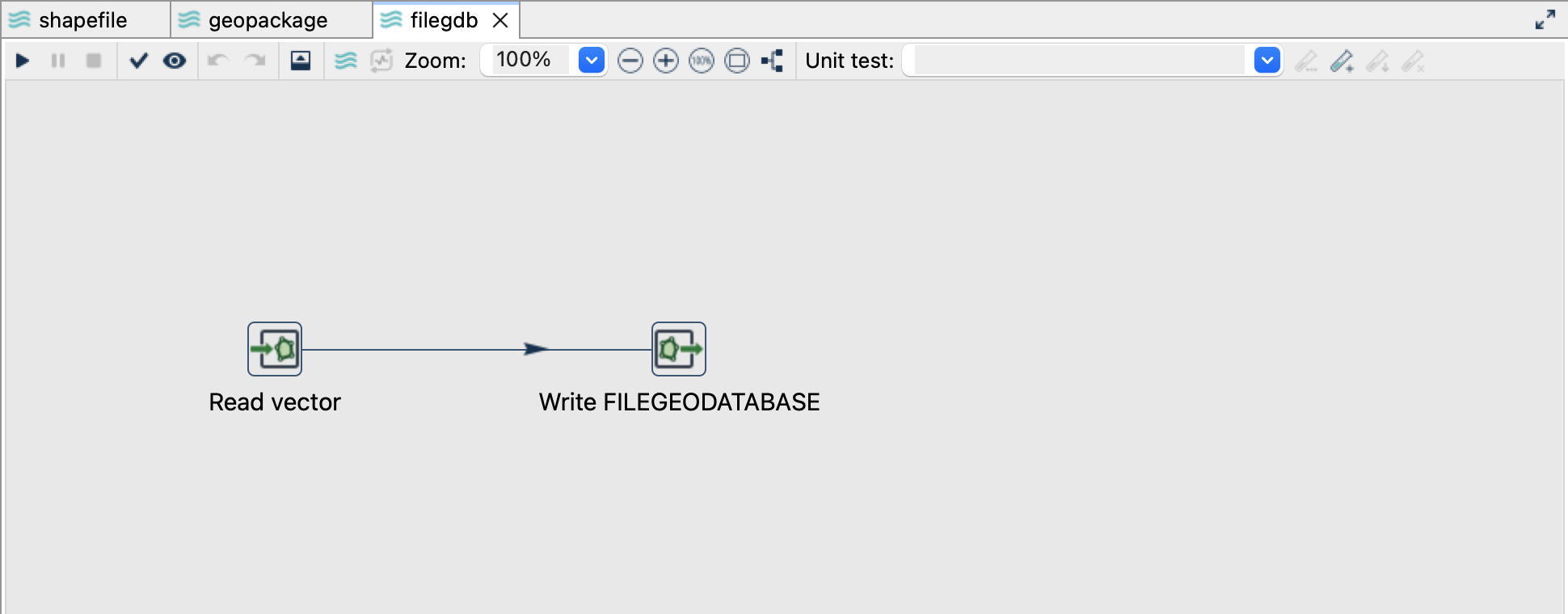
Read the source
- Open
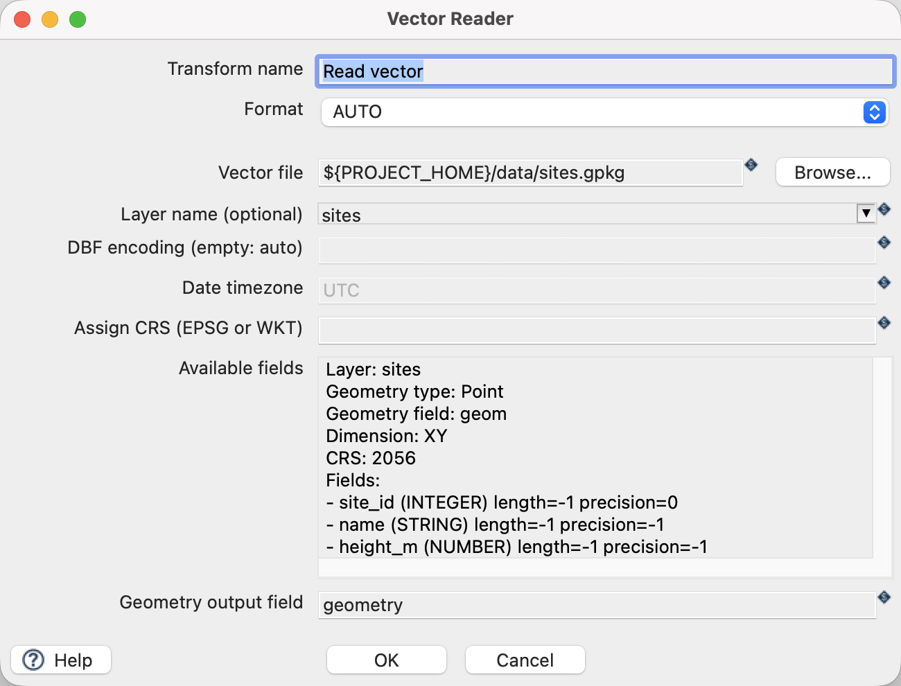
filegdb.hplfrom the example project. - Click Read vector and choose Edit. The file is
${PROJECT_HOME}/data/sites.gpkg, formatAUTO, layersites, and geometry output fieldgeometry. - Use the source schema/preview controls to inspect the fields. Expect
site_id,name,height_mand a geometry field. The source contains three point features in EPSG:2056. - Close the reader dialog with OK, then click the writer and choose Edit.
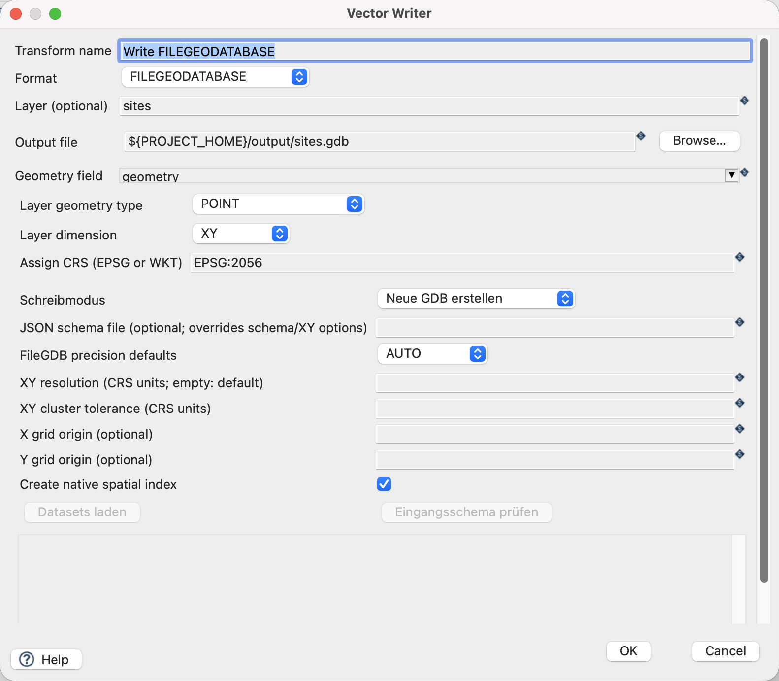
Configure the writer
| Setting | Value |
|---|---|
| Format | FILEGEODATABASE |
| Output file | ${PROJECT_HOME}/output/sites.gdb |
| Layer | sites |
| Geometry field | geometry |
| Assign CRS | EPSG:2056 |
| Write mode (Schreibmodus) | Neue GDB erstellen (CREATE_DATABASE) |
| Precision mode | AUTO |
| Spatial index | On |
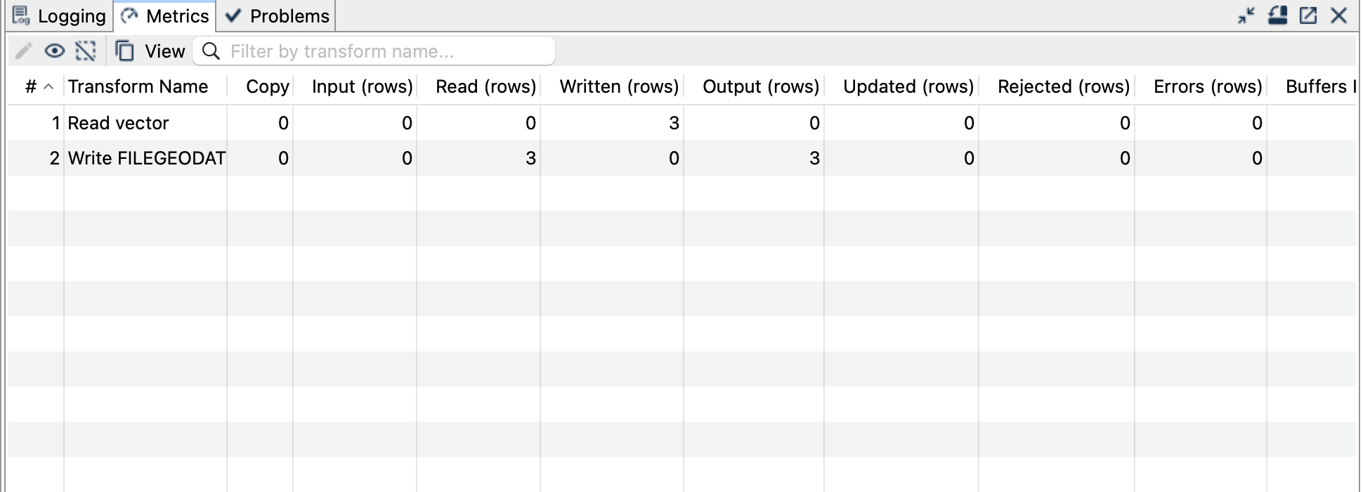
Run and check the result
Run filegdb.hpl once. The output sites.gdb is a directory containing a dataset named sites, with three point features. Keep the entire directory together when copying it.
Open and run read-filegdb.hpl. Its reader points to ${PROJECT_HOME}/output/sites.gdb and explicitly selects sites. The writer creates output/filegdb-readback.gpkg. Check three geometries, the original site_id values, the names and heights.
For projected EPSG:2056, AUTO precision uses a 0.0001 metre XY resolution and 0.001 metre tolerance. These fixture coordinates lie exactly on that grid. For real data, inspect the precision settings before expecting an exact roundtrip.
Things to watch out for
OBJECTIDis generated as the geodatabase’s row identifier; retain a separate business key such assite_id. A source attribute namedOBJECTIDis exported asSOURCE_OBJECTID, with collisions reported as errors.- XY resolution/tolerance describe coordinate storage and processing precision. They are not a curve-approximation tolerance.
- FileGDB can preserve supported circular curves and Z/M, but this introductory dataset tests XY points only.
- The separate FileGDB Catalog Reader and FileGDB Writer cover domains, relationships and richer multi-dataset exports. This tutorial uses the generic Vector Reader/Writer.
- Use a new
.gdbdirectory for a repeat, or remove only the generatedoutput/sites.gdbdirectory first.
The CRS controls assign a coordinate reference system; they do not reproject coordinates. All coordinates in this example already use EPSG:2056.