Export an indexed FlatGeobuf file
All vector examples · Vector Raster plugin
Export the three sites into one indexed FlatGeobuf file for downstream tools that support the format.
Before you begin
Download and set up the example project. This walkthrough uses Apache Hop 2.19.0, distribution 0.2.1-SNAPSHOT.build.35761791293.1, with the local run configuration. Keep the supplied input unchanged and use a writable output directory.
Download flatgeobuf.hpl · Complete project ZIP
The individual pipeline requires the data and project configuration from the complete ZIP.
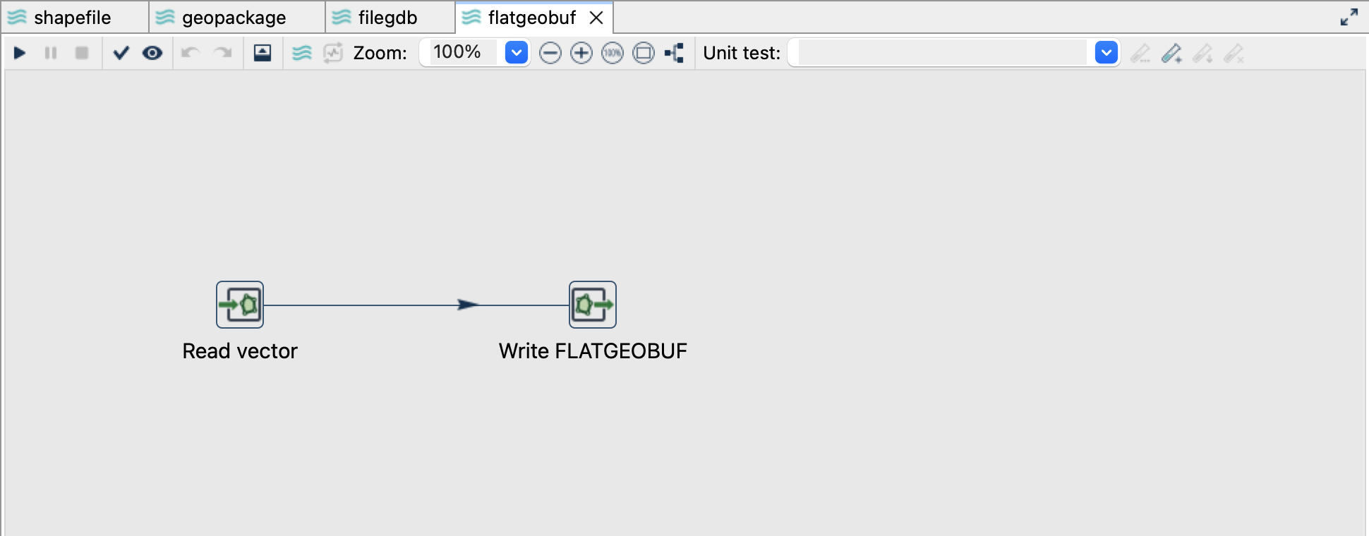
Read the source
- Open
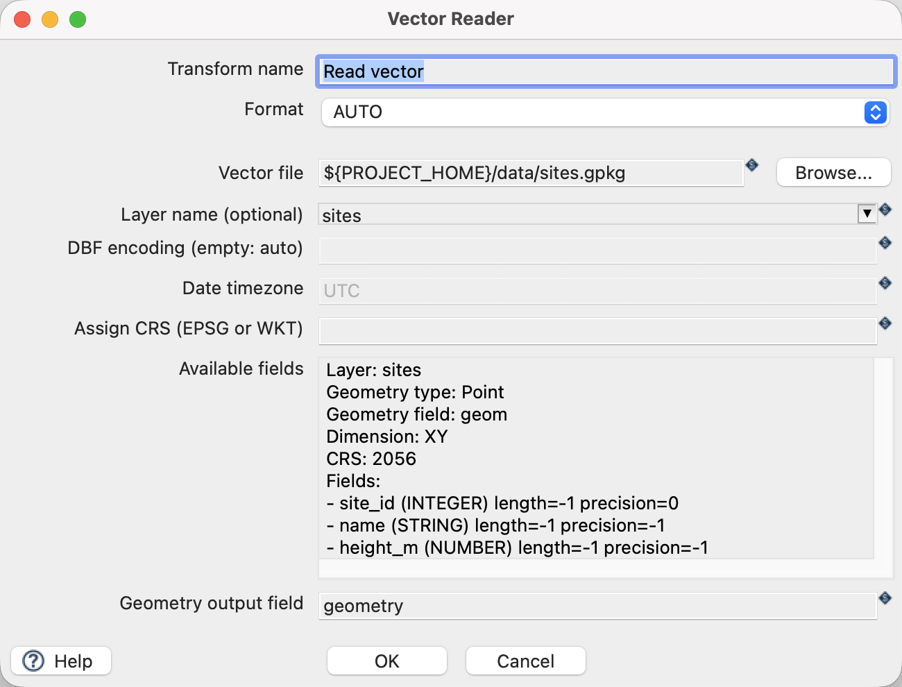
flatgeobuf.hplfrom the example project. - Click Read vector and choose Edit. The file is
${PROJECT_HOME}/data/sites.gpkg, formatAUTO, layersites, and geometry output fieldgeometry. - Use the source schema/preview controls to inspect the fields. Expect
site_id,name,height_mand a geometry field. The source contains three point features in EPSG:2056. - Close the reader dialog with OK, then click the writer and choose Edit.
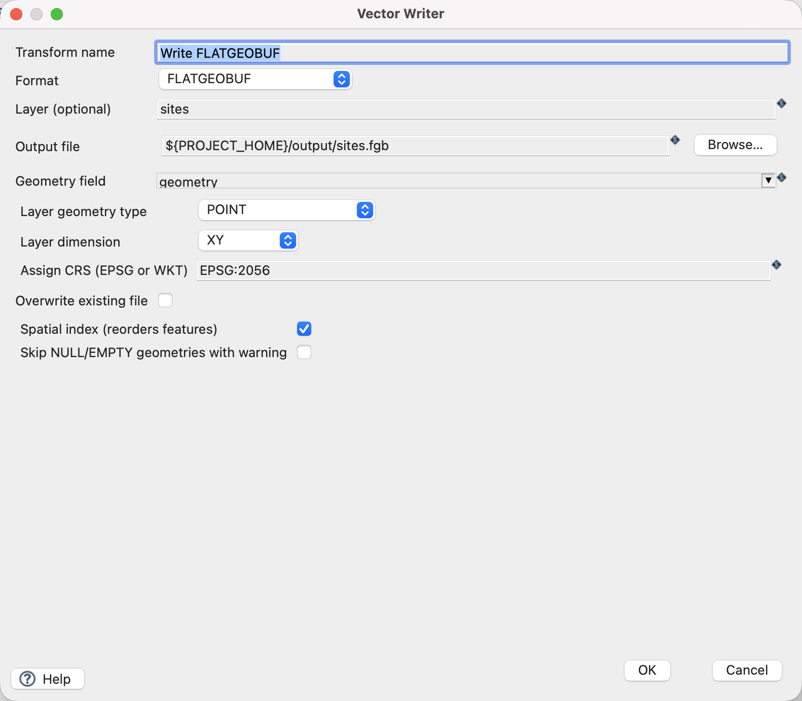
Configure the writer
| Setting | Value |
|---|---|
| Format | FLATGEOBUF |
| Output file | ${PROJECT_HOME}/output/sites.fgb |
| Geometry field | geometry |
| Layer geometry type | POINT |
| Layer dimension | XY |
| Assign CRS | EPSG:2056 |
| Spatial index (reorders features) | On |
| Skip NULL/EMPTY geometries with warning | Off |
| Overwrite existing file | Off |
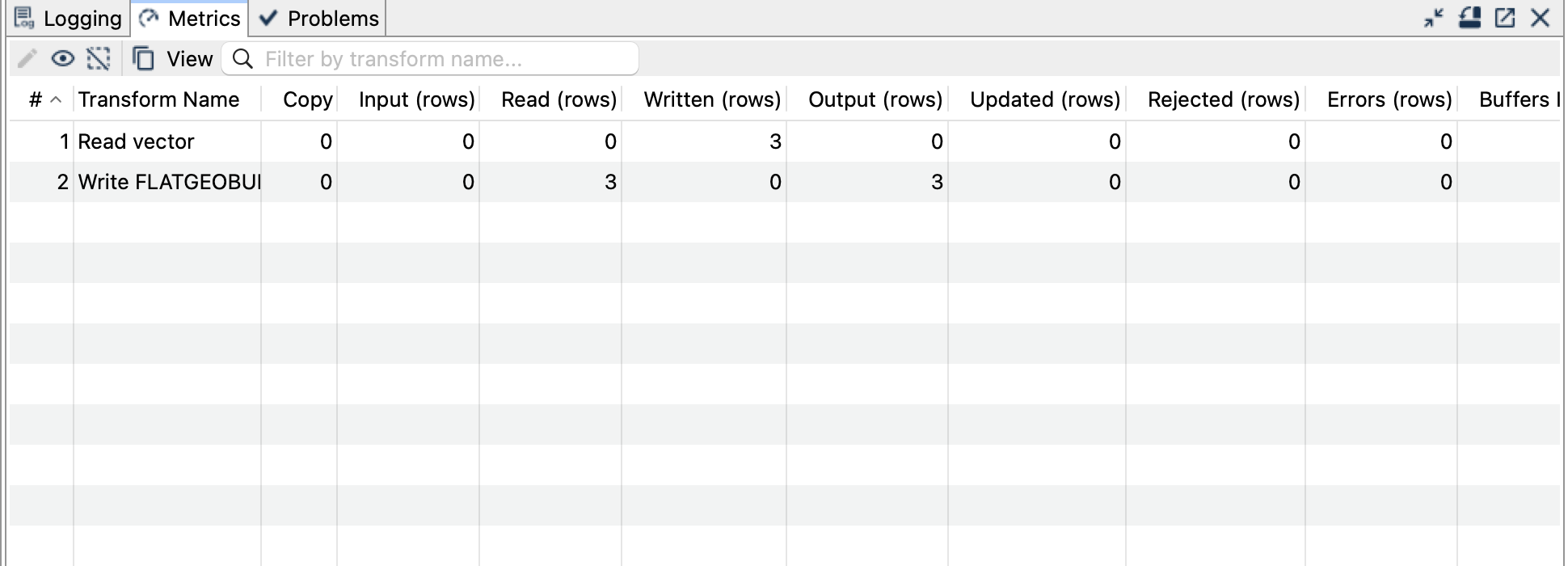
Run and check the result
Save and run flatgeobuf.hpl. Expect one .fgb file containing three XY point features with all three attributes. Check the result by matching site_id, rather than comparing row positions: the spatial index can reorder features.
Open the output in a FlatGeobuf-capable GIS or inspect it with ogrinfo -al output/sites.fgb if GDAL is installed. GDAL is an optional independent checker; it is not required by GeoHop. Vector Reader cannot read this format in the documented distribution.
Things to watch out for
- Indexed output rejects NULL/EMPTY geometries by default. Turning on the skip option drops those rows with a warning; reconcile the output count if you choose it.
- Disabling the spatial index preserves input order. Index creation can require substantial memory and temporary disk space for larger datasets.
- Select an explicit geometry type and dimension for empty input instead of depending on schema inference.
- Supported curve inputs are linearized for this output. The tutorial’s plain XY points do not exercise curve or Z/M behaviour.
- Do not connect this file to Vector Reader for a roundtrip: this format is output-only here.
The CRS controls assign a coordinate reference system; they do not reproject coordinates. All coordinates in this example already use EPSG:2056.