Read, inspect and write rasters
All raster tutorials · Vector Raster plugin
Read the local 2019 nDSM, inspect its metadata and write a lossless GeoTIFF or Cloud Optimized GeoTIFF (COG).
Before you begin
Set up the complete raster project. Tested on 3 October 2026, Apache Hop 2.19.0, Java 21.0.10, with the plugin builds recorded in the ZIP’s tested-environment.json. Use the local run configuration.
Download read-write-geotiff.hpl · Download read-write-cog.hpl
Complete project ZIP. Individual pipelines need the data and metadata from that ZIP.
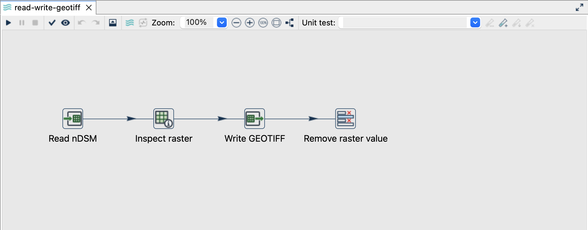
Read and inspect
- Open
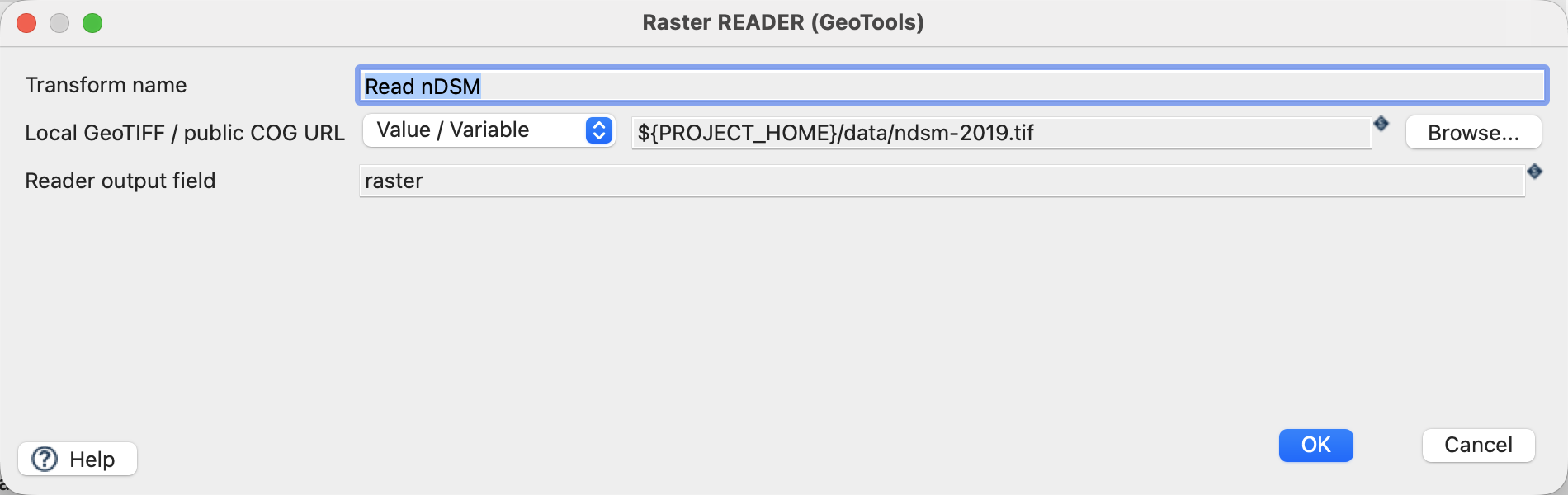
read-write-geotiff.hpl. - Click Read nDSM → Edit. Select Value / Variable, source
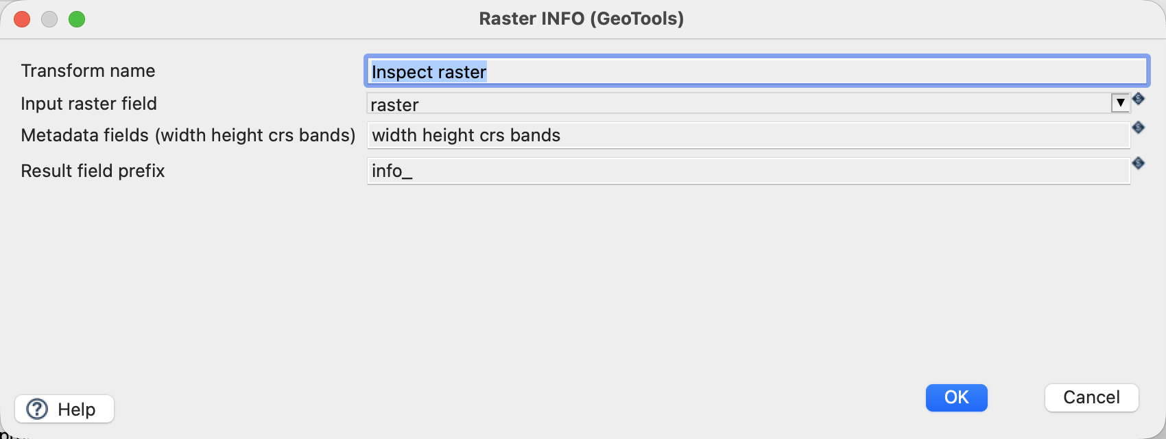
${PROJECT_HOME}/data/ndsm-2019.tif, output fieldraster. - Open Inspect raster. Keep the input field
raster, prefixinfo_and metadata selectionwidth height crs bands.
Configure the writer
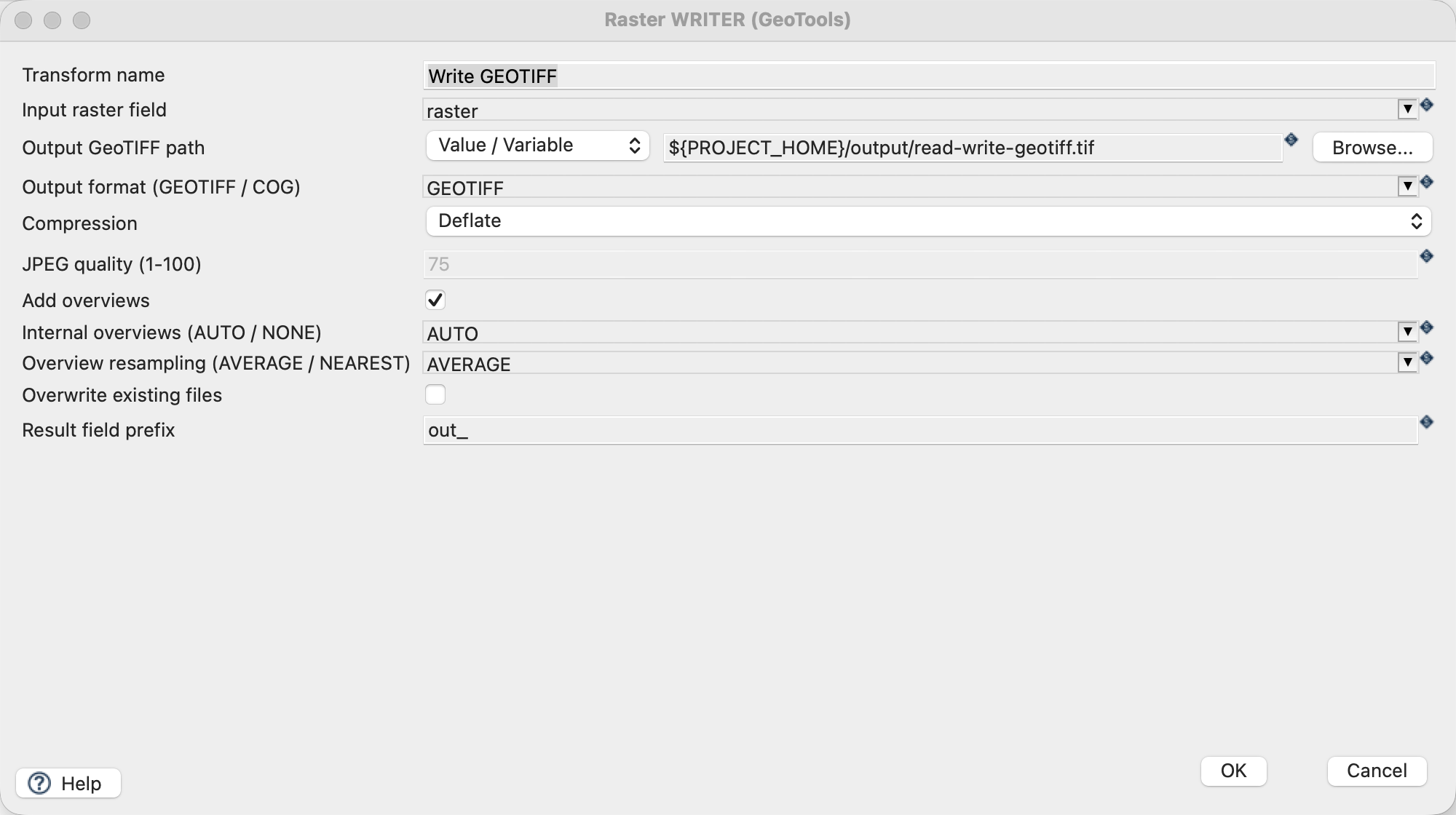
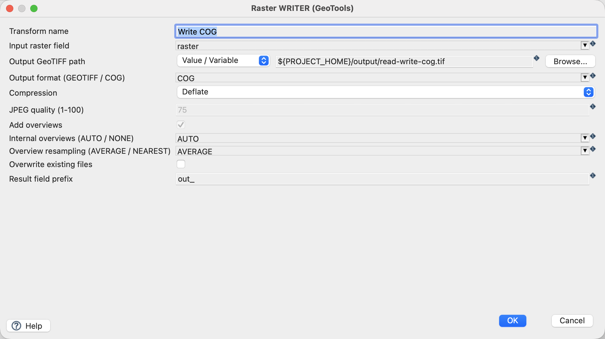
| Setting | GeoTIFF pipeline | COG pipeline |
|---|---|---|
| Input raster field | raster |
raster |
| Output path | ${PROJECT_HOME}/output/read-write-geotiff.tif |
${PROJECT_HOME}/output/read-write-cog.tif |
| Output format | GEOTIFF |
COG |
| Compression | Deflate |
Deflate |
| Add overviews | On | Controlled by COG format |
| Internal overviews / resampling | AUTO / AVERAGE |
AUTO / AVERAGE |
| Overwrite / result prefix | Off / out_ |
Off / out_ |
Run and check
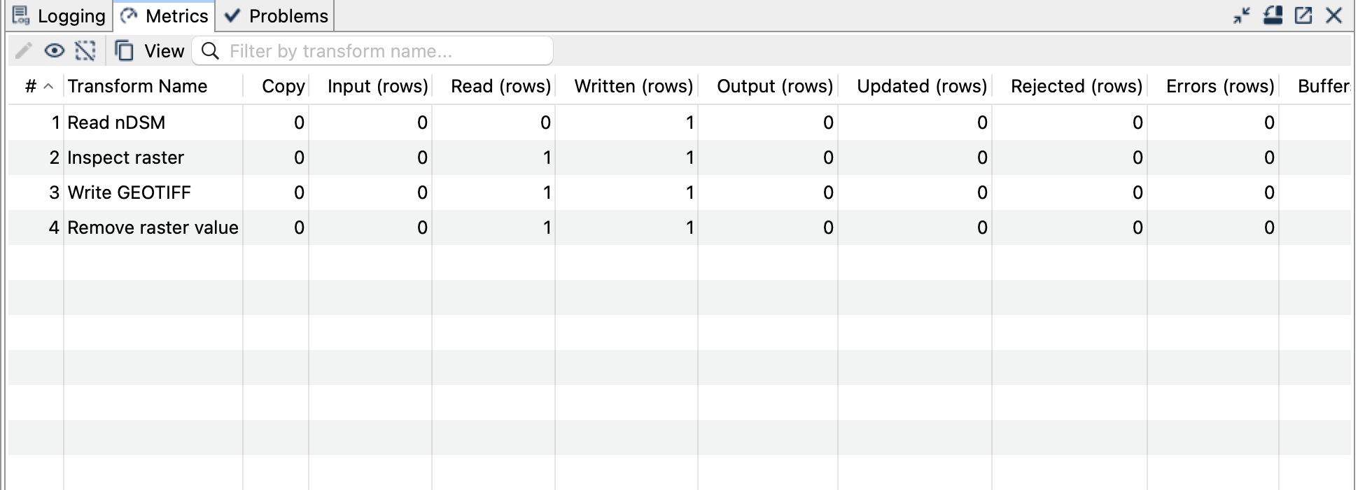
Run each pipeline once. Each processes one row, representing the entire raster. Remove raster value removes the typed raster from the final row, leaving inspectable metadata and writer status.
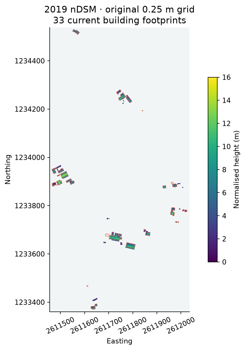
Expect 2322 × 4709 pixels, one Float32 band, EPSG:2056 and NoData -9999. The full-resolution values and georeferencing match the input exactly. Both outputs have internal overviews; the COG additionally uses a layout suitable for HTTP range access. The COG structure was independently validated with GDAL.
Things to watch out for
- Metadata fields describe the raster; they do not expose every pixel as a Hop row.
- Use distinct prefixes for Info (
info_) and Writer (out_) to prevent field collisions. Deflatepreserves numeric samples. JPEG is lossy and is unsuitable for this Float32 height raster.- Overview resampling affects the reduced-resolution images, not the full-resolution raster.
- A local COG becomes remotely readable only when its server correctly supports HTTP range requests.
- Existing files are protected. Change the path or remove only the generated output before repeating a run.